
جانیا:Sikkim locator map.svg

حجم پیشنمایش PNG این SVG file:۴۲۴ × ۶۰۰ پیکسل هنیگۉپ نما کردنؽا: ۱۷۰ × ۲۴۰ پیکسل | ۳۳۹ × ۴۸۰ پیکسل | ۵۴۳ × ۷۶۸ پیکسل | ۷۲۴ × ۱٬۰۲۴ پیکسل | ۱٬۴۴۸ × ۲٬۰۴۸ پیکسل | ۱٬۵۹۵ × ۲٬۲۵۶ پیکسل.
جانؽا ٱسلی (جانؽا اْس ڤی جی, نومی ۱٬۵۹۵ × ۲٬۲۵۶ پیکسل, ٱندازٱ جانؽا: ۲۴۴ کیلوبایت)
| عنوان مقاله |
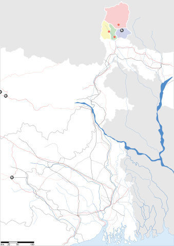
Sikkim locator map |
||
| Description |
Map of w:Sikkim with road and rail lines. Equirectangular projection. Geographic limits of the map: top=28.15, bottom=21.48, left=84.99, right=90.15. |
||
| گات | |||
| سرچشمٱ |
کار خود |
||
| پدیدآورنده |
|
||
| دٱسرسی (د نۊ ڤ کار گرتن اؽ جانؽا) |
من، صاحب حقوق قانونی این اثر، به این وسیله این اثر را تحث اجازهنامهٔ ذیل منتشر میکنم: اؽ جانؽا زؽرنٱخیز لیسانس Creative Commons Attribution-Share Alike 3.0 Unported ٱ .
|
||
| Geotemporal data | |||
| Date depicted | نیمهٔ دوم سدهٔ 20 و سدهٔ 21 | ||
| Georeferencing | If inappropriate please set warp_status = skip to hide. | ||
| Archival data | |||
| یادداشتها | Part of WikiProject India Maps | ||
ڤیرگار جانؽا
ری ڤيرگارؽا بٱپۊرنؽت تا نۏسخٱ مٱربۊتاْ باٛینؽت.
| ڤيرگار/ڤٱخت | عٱسگ کوچک بیٱ | اۊیٱکؽا | کاریار | ڤیر ۉ باڤٱر | |
|---|---|---|---|---|---|
| تازٱ با | ۱۲ ماٛی ۲۰۰۷، ساعت ۰۹:۵۸ | | ۱٬۵۹۵ در ۲٬۲۵۶ (۲۴۴ کیلوبایت) | Planemad | border fix |
| ۷ ماٛی ۲۰۰۷، ساعت ۱۹:۲۰ |  | ۱٬۵۹۵ در ۲٬۲۵۶ (۲۵۲ کیلوبایت) | Planemad | border | |
| ۷ ماٛی ۲۰۰۷، ساعت ۱۹:۱۴ |  | ۱٬۵۹۵ در ۲٬۲۵۶ (۲۴۵ کیلوبایت) | Planemad | {{WikiProject_India_Maps |Title=Gujarat locator map.svg locator map |Description=Map of w:Gujarat locator map.svg with road and rail lines. |Source= |Date=May 2007 |Author=w:user:Planemad }} Category:WikiProject India State Maps |
ڤ کار گرتن جانؽا
ایچاْ هیچ بٱلگاٛیی سی هوم پیاٛڤٱن بیئن ڤا اؽ جانؽا نؽ