
جانیا:Maricopa County Incorporated and Planning areas Chandler highlighted.svg

حجم پیشنمایش PNG این SVG file:۶۹۴ × ۵۹۹ پیکسل هنیگۉپ نما کردنؽا: ۲۷۸ × ۲۴۰ پیکسل | ۵۵۶ × ۴۸۰ پیکسل | ۸۸۹ × ۷۶۸ پیکسل | ۱٬۱۸۵ × ۱٬۰۲۴ پیکسل | ۲٬۳۷۱ × ۲٬۰۴۸ پیکسل | ۹۴۰ × ۸۱۲ پیکسل.
جانؽا ٱسلی (جانؽا اْس ڤی جی, نومی ۹۴۰ × ۸۱۲ پیکسل, ٱندازٱ جانؽا: ۱٫۰۵ مگابایت)
چکسٱ
| تۉزی |
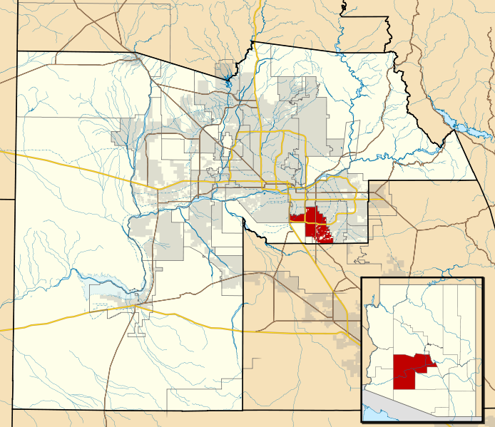
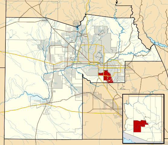
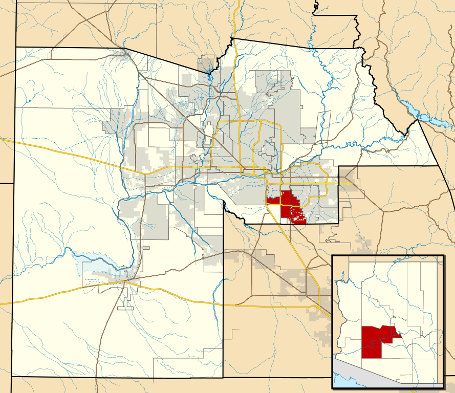
This map shows the incorporated areas and Indian reservation boundaries in Maricopa County, Arizona, along with water bodies and major highways and roads.
|
| گات | |
| سرچشمٱ | My own work, based on government information |
| نڤیسیار | Ixnayonthetimmay |
| دٱسرسی (د نۊ ڤ کار گرتن اؽ جانؽا) |
Public Domain |
| دیگر نسخهها | See Category:Maps of Maricopa County for other versions of this image. |
د هال ۉ بار لیسانس دار بیئن
| من، دارنده حق تکثیر این اثر، این اثر را به مالکیت عمومی منتشر میکنم. این قابل اجرا در تمام نقاط جهان است. در برخی از کشورها ممکن است به صورت قانونی این امکانپذیر نباشد؛ اگر چنین است: من اجازهٔ استفاده از این اثر را برای هر مقصودی، بدون هیچگونه شرایطی میدهم، تا وقتی که این شرایط توسط قانون مستلزم نشده باشد. |
ڤیرگار جانؽا
ری ڤيرگارؽا بٱپۊرنؽت تا نۏسخٱ مٱربۊتاْ باٛینؽت.
| ڤيرگار/ڤٱخت | عٱسگ کوچک بیٱ | اۊیٱکؽا | کاریار | ڤیر ۉ باڤٱر | |
|---|---|---|---|---|---|
| تازٱ با | ۲۰ ماٛی ۲۰۱۱، ساعت ۰۶:۱۵ | | ۹۴۰ در ۸۱۲ (۱٫۰۵ مگابایت) | Ixnayonthetimmay | Uploading new version |
| ۳۰ آگوست ۲۰۰۸، ساعت ۰۴:۰۱ |  | ۹۰۰ در ۸۰۰ (۴۱۳ کیلوبایت) | Ixnayonthetimmay | == Summary == {{Information |Description=This map shows the incorporated areas and unincorporated areas in Maricopa County, Arizona. [[:en:Chandler, Arizona| | |
| ۱۵ سپتامر ۲۰۰۷، ساعت ۲۳:۵۷ |  | ۹۰۰ در ۸۰۰ (۳۸۴ کیلوبایت) | Ixnayonthetimmay | ||
| ۱۵ سپتامر ۲۰۰۷، ساعت ۲۳:۵۶ |  | ۹۰۰ در ۸۰۰ (۳۸۴ کیلوبایت) | Ixnayonthetimmay | == Summary == {{Information |Description=This map shows the incorporated areas in Maricopa County, Arizona. It also shows the boundaries for the municipal planning areas. The [[:en:Fort | |
| ۲۸ ماٛی ۲۰۰۷، ساعت ۰۹:۵۲ |  | ۹۰۰ در ۷۸۰ (۳۲۹ کیلوبایت) | Ixnayonthetimmay | ||
| ۲۱ ماٛی ۲۰۰۷، ساعت ۲۳:۵۴ |  | ۹۰۰ در ۷۸۰ (۳۱۸ کیلوبایت) | Ixnayonthetimmay | ||
| ۳۰ ژانڤیٱ ۲۰۰۷، ساعت ۰۴:۵۵ |  | ۹۰۴ در ۷۵۸ (۱۷۷ کیلوبایت) | Ixnayonthetimmay | {{Information |Description=This map shows the incorporated areas in Maricopa County, Arizona, highlighting Chandler in red. It also shows the boundaries for the |
ڤ کار گرتن جانؽا
ایچاْ هیچ بٱلگاٛیی سی هوم پیاٛڤٱن بیئن ڤا اؽ جانؽا نؽ