جانیا:Kyrgyzstan (orthographic projection).svg
Page contents not supported in other languages.
د ڤیکیپدیا، دونسمنامٱ آزاد

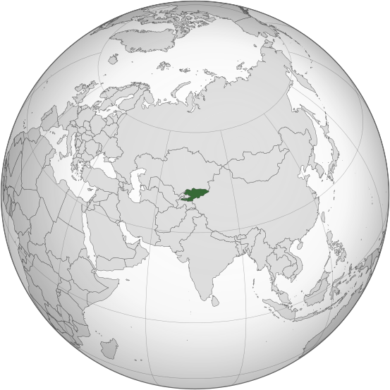
جانؽا ٱسلی(جانؽا اْس ڤی جی, نومی ۵۵۳ × ۵۵۳ پیکسل, ٱندازٱ جانؽا: ۳۴۶ کیلوبایت)

فایلٛؽ کاْ د ویکی‌انبار شایٱد د مؽن پرۉژٱیا هنی اْستفادٱ بیٱ. تۉزیی دبارٱfile description page د هار نشوݩ داٛئٱ بیٱ

چکسٱ

تۉزی
English: Location of Kyrgyzstan
گات
سرچشمٱ Based on the File:Tajikistan (orthographic projection).svg
نڤیسیار UN, The original uploader was RaviC در ویکی پدیا ئینگیلیسی.
SVG genesis
InfoField
 
کد مبدأ این پروندهٔ گرافیک برداری مقیاس‌پذیر، معتبر.
 
این نقشهٔ جهان با Adobe Illustrator ساخته شده است,
 
and with Inkscape.
 
This Adobe SVG world map is very large because its creator kept the superfluous Adobe PGF or other CDATA garbage
.

د هال ۉ بار لیسانس دار بیئن

Public domain This image is a map derived from a United Nations map.

Unless stated otherwise, UN maps are to be considered in the public domain. This applies worldwide.
Some UN maps have special copyrights, as indicated on the map itself.

UN maps are, in principle, open source material and you can use them in your work or for making your own map. UN requests however that you delete the UN name, logo and reference number upon any modification to the map. Content of your map will be your responsibility. You can state in your publication, if you wish, something like: based on UN map … (map name, map number, revision number and date). See: Geospatial Information Section. And: Geospatial, location data for a better world.

عنوان

شرحی یک‌خطی از محتوای این فایل اضافه کنید

آیتم‌هایی که در این پرونده نمایش داده شده‌اند

توصیف‌ها فارسی

۱۰ جۊلای 2012

image/svg+xml

ڤیرگار جانؽا

ری ڤيرگارؽا بٱپۊرنؽت تا نۏسخٱ مٱربۊتاْ باٛینؽت.

ڤيرگار/ڤٱختعٱسگ کوچک بیٱاۊیٱکؽاکاریارڤیر ۉ باڤٱر
تازٱ با‏۳۱ جۊلای ۲۰۲۳، ساعت ۰۱:۰۸كوچک کردن سی نۏسخٱ چی ‏۳۱ جۊلای ۲۰۲۳، ساعت ۰۱:۰۸۵۵۳ در ۵۵۳ (۳۴۶ کیلوبایت)Cutlassrv sock edits
‏۶ ژۊئٱن ۲۰۲۳، ساعت ۱۶:۰۹كوچک کردن سی نۏسخٱ چی ‏۶ ژۊئٱن ۲۰۲۳، ساعت ۱۶:۰۹۵۵۳ در ۵۵۳ (۳۱۰ کیلوبایت)CutlerysReverted to version as of 12:34, 4 August 2013 (UTC)
‏۶ ژۊئٱن ۲۰۲۳، ساعت ۱۶:۰۸كوچک کردن سی نۏسخٱ چی ‏۶ ژۊئٱن ۲۰۲۳، ساعت ۱۶:۰۸۵۵۳ در ۵۵۳ (۳۰۶ کیلوبایت)CutlerysReverted to version as of 23:39, 16 March 2015 (UTC)
‏۱ ماٛی ۲۰۱۶، ساعت ۱۸:۱۷كوچک کردن سی نۏسخٱ چی ‏۱ ماٛی ۲۰۱۶، ساعت ۱۸:۱۷۵۵۳ در ۵۵۳ (۳۴۶ کیلوبایت)Nicolay Sidorov...
‏۱۶ مارس ۲۰۱۵، ساعت ۲۳:۳۹كوچک کردن سی نۏسخٱ چی ‏۱۶ مارس ۲۰۱۵، ساعت ۲۳:۳۹۵۵۳ در ۵۵۳ (۳۰۶ کیلوبایت)FlappiefhRemoved Somaliland and Kosovo. Separated Western Sahara and Morroco.
‏۴ آگوست ۲۰۱۳، ساعت ۱۲:۳۴كوچک کردن سی نۏسخٱ چی ‏۴ آگوست ۲۰۱۳، ساعت ۱۲:۳۴۵۵۳ در ۵۵۳ (۳۱۰ کیلوبایت)FlappiefhAdded South Sudan. The map is now centered on Kyrgyzstan.
‏۹ جۊلای ۲۰۱۲، ساعت ۱۶:۰۲كوچک کردن سی نۏسخٱ چی ‏۹ جۊلای ۲۰۱۲، ساعت ۱۶:۰۲۵۵۰ در ۵۵۰ (۴۹۰ کیلوبایت)Hariboneagle927

ایچاْ هیچ بٱلگاٛیی سی هوم پیاٛڤٱن بیئن ڤا اؽ جانؽا نؽ

رسینٱیا فرٱ گٱپ