
جانیا:Kerala locator map.svg

حجم پیشنمایش PNG این SVG file:۴۹۴ × ۶۰۰ پیکسل هنیگۉپ نما کردنؽا: ۱۹۸ × ۲۴۰ پیکسل | ۳۹۵ × ۴۸۰ پیکسل | ۶۳۲ × ۷۶۸ پیکسل | ۸۴۳ × ۱٬۰۲۴ پیکسل | ۱٬۶۸۷ × ۲٬۰۴۸ پیکسل | ۱٬۳۴۰ × ۱٬۶۲۷ پیکسل.
جانؽا ٱسلی (جانؽا اْس ڤی جی, نومی ۱٬۳۴۰ × ۱٬۶۲۷ پیکسل, ٱندازٱ جانؽا: ۱۵۱ کیلوبایت)
| عنوان مقاله |
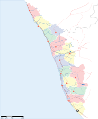
Kerala locator map |
||
| Description |
Locator map for the state of w:Kerala |
||
| گات | |||
| سرچشمٱ |
کار خود |
||
| پدیدآورنده |
|
||
| دٱسرسی (د نۊ ڤ کار گرتن اؽ جانؽا) |
من، صاحب حقوق قانونی این اثر، به این وسیله این اثر را تحث اجازهنامهٔ ذیل منتشر میکنم: اؽ جانؽا زؽرنٱخیز لیسانس Creative Commons Attribution-Share Alike 3.0 Unported ٱ .
|
||
| Geotemporal data | |||
| Date depicted | نیمهٔ دوم سدهٔ 20 و سدهٔ 21 | ||
| Georeferencing | If inappropriate please set warp_status = skip to hide. | ||
| Archival data | |||
| یادداشتها | Part of WikiProject India Maps | ||
ڤیرگار جانؽا
ری ڤيرگارؽا بٱپۊرنؽت تا نۏسخٱ مٱربۊتاْ باٛینؽت.
| ڤيرگار/ڤٱخت | عٱسگ کوچک بیٱ | اۊیٱکؽا | کاریار | ڤیر ۉ باڤٱر | |
|---|---|---|---|---|---|
| تازٱ با | ۱۳ آڤریل ۲۰۰۷، ساعت ۱۴:۵۳ | | ۱٬۳۴۰ در ۱٬۶۲۷ (۱۵۱ کیلوبایت) | Planemad | correcting crop |
| ۱۳ آڤریل ۲۰۰۷، ساعت ۱۴:۵۲ |  | ۱٬۵۹۱ در ۱٬۹۷۵ (۱۵۲ کیلوبایت) | Planemad | ||
| ۹ آڤریل ۲۰۰۷، ساعت ۱۸:۰۹ |  | ۱٬۳۲۳ در ۱٬۶۰۷ (۶۸ کیلوبایت) | Planemad | {{WikiProject_India_Maps |Title=Kerala locator map |Description=Locator map for the state of [w:Kerala]] |Source= [http://keralapolice.org/map/keralamap.html Kerala Police - Map of Kerala], |Date=April 2007 |Author=w:user:Planemad }} [[Category:Wiki |
ڤ کار گرتن جانؽا
ایچاْ هیچ بٱلگاٛیی سی هوم پیاٛڤٱن بیئن ڤا اؽ جانؽا نؽ